
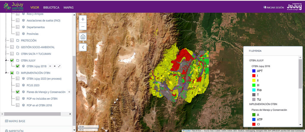
The Native Forest Viewer, managed by the Ministry of Environment and Climate Change of Jujuy, provides users with a detailed overview of the province’s native forests, local waterways, conservation areas and green corridors, glaciers and wetlands, and the distribution of indigenous communities. The tool guarantees compliance with the law by cross referencing information from two unconnected data sources: the Native Forest Territorial Management (OTBN) system with the permits granted by the provincial authority for land use change.
NOTE: Argentinian provinces are required to update their OTBN every five years. This information is combined with environmental and social studies to determine the areas where land use change can occur (Category III: Green), where certain activities, such as managed forestry or silvopastoral livestock production, are allowed (Category II: Yellow), and which areas are under legal production due to their high conservation value (Category I: Red).
“Viewing a permit on an interactive map is different from looking up a land use permit and an OTBN map separately and then manually cross-referencing them,” explains Camila Torres, Solidaridad’s Project Manager. “The Viewer allows us to layer two different pieces of information on the same map, and opens up the possibility of adding additional information layers later.”
“The Viewer strengthens environmental governance in the province, and supports the policy of conservation and sustainable use of native forests.”
María Inés Zigarán, the Minister of Environment and Climate Change in Jujuy.
Javier Albanesi, Director of Forestry and Land Use Management at the Ministry of Environment and Climate Change of Jujuy, explained: “We will have a link on our website so the general public can access the Viewer and – along with viewing the information as digital layers – can consult other associated data.”
“Providing an open and publicly accessible tool, allows us to democratize information and provide transparency,” adds Camila Torres.
Each type of information is loaded as a layer that can be superimposed on the others to answer different queries. For example:
- A company can use the Viewer to corroborate that its supply chain complies with the Forestry Law and does not contribute to illegal deforestation.
- A producer can use the Viewer to confirm the areas of their property that are eligible for land use change, review a specific management plan or identify proximity to critical biological corridors.
The antecedent: Salta
The decision to develop the Viewer emerged in 2022 during an exchange at a Multisectoral Dialogue Roundtable held in the province of Salta, where Solidaridad presented a version of the Viewer created with the Secretariat of Environment and Sustainable Development of the Province of Salta. Personnel from Jujuy’s Ministry of Environment and Climate Change were at the event and were immediately interested in replicating the tool.
“In addition to being one of the jurisdictions with the highest performance in terms of forest mass protection, we wanted to redouble efforts to improve the management and monitoring of native forests,” María Inés Zigarán said.
“This is a tool that I consider very agile, easy to use, intuitive, and very useful for environmental education at different levels.”
Javier Albanesi, Director of Forestry and Land Use Management at the Ministry of Environment and Climate Change of Jujuy
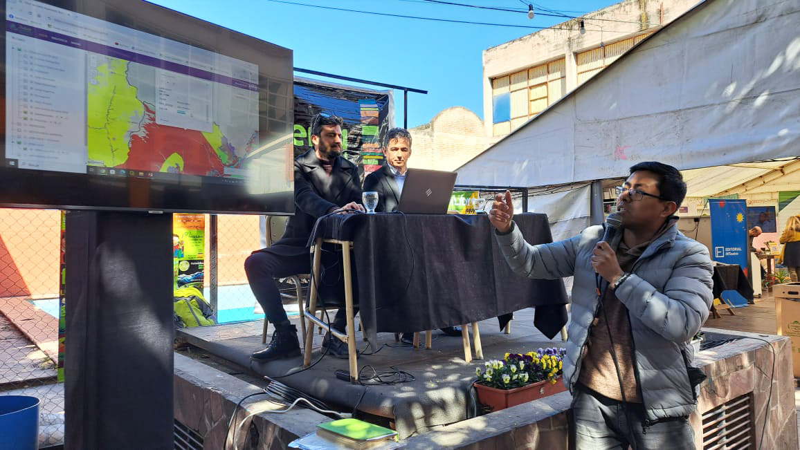
The development of the Jujuy Viewer spanned two years and was launched together with the Provincial Plan for mitigation and adaptation to climate change, prepared by the Ministry of Environment and Climate Change. During the launch, attendees were invited to participate in a training session on the use of the Viewer.
In addition, developers of the viewer made a call other information that can be incorporated into the viewer providing users with a comprehensive tool to better manage forested areas, including the possibility of adding wildlife corridors or integrating urban forested areas.
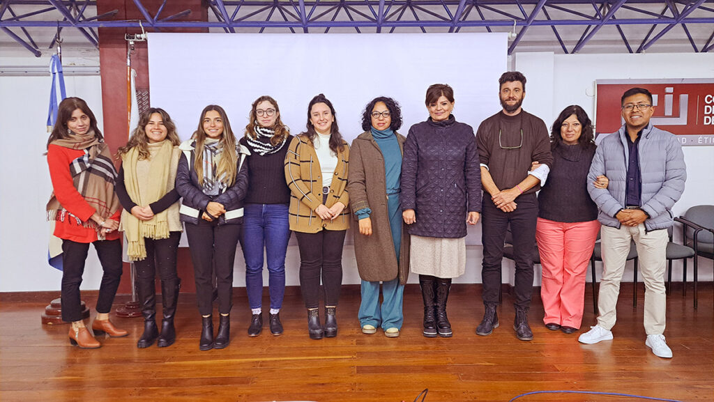
María Inés Zigarán highlighted the work of all the actors that supported development of the Forest Viewer, including Solidaridad, ProYungas, and the ministry she leads.
“The link that was generated between these three organizations has been a profitable synergy, and has served to link different areas of management and governance to result in a modern tool that provides access to information and transparency”.
Developing the Forest Viewer
For the technical development of the Viewers for Salta and Jujuy, Fundación ProYungas called on previous experience developing digital tools for private and public actors.
“One of ProYungas’ objectives is to generate quality information covering environmental, productive and social aspects of the Norte Grande of Argentina and make this available for decision making, through tools lik the viewer,” said Sebastián Malizia, Executive Director of ProYungas. “In this case, we developed [a tool] with Solidaridad that seeks to strengthen and provide greater visibility to local authorities implementing, monitoring and following-up on the Forestry Law.”
The first step in these processes is corroborating the information and what kind of infrastructure is available. If the information is digitized and there servers to host the necessary information, the process can be easier. For example, the government of Salta had a lot of information on land use change permits, but it was not digitized. It took a full year of work to digitize the permits so that they could be uploaded to the Viewer. In the case of Jujuy, most of the information was already digitized, which accelerated development times.
Secondly, an agreement is signed with the province and a provincial technical team is hired to carry out the uploading to the Viewer. This staff is usually local personnel. In the cases of Salta and Jujuy, ProYungas trained the technical on how to use the servers, load the layers and perform updates. Once the Viewer was ready, user manuals were written and the remaining staff were trained.
Points for improvement and next steps
Although the Viewers are an important milestone, there is room for improvement. For example, for the time being the Viewer needs to be manually updated each time the OTBN of the province is updated. But there are also exciting advances that could make the tool even more useful. For example, the Viewers could be linked to an early warning system for unapproved land use changes or forest fires, similar to a system used in Brazil. Or the Viewers could be connected with platforms that support traceability for deforestation-free soybean and meat value chains.
“With Cargill’s support, the idea now is to replicate the Viewer in other provinces of the Gran Chaco of Argentina. We are in the process of signing an agreement with the province of Tucumán,” says Juan Sebastián Entrocassi, Solidaridad Manager for Argentina and Paraguay. “Our expectation is that development in Tucumán will be relatively fast since most of its information has been digitized”.